כיכר השבת
Gila Isaacson |
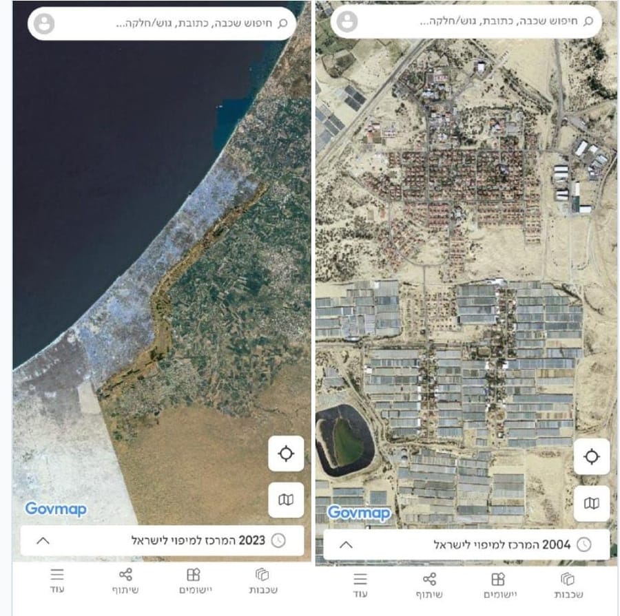
The Survey of Israel Updates National Map Interface: Gaza Strip Reappears
The Survey of Israel (MAPI) has updated its official government mapping interface and an unexpected change has drawn attention. For the first time in years, the Gaza Strip has been restored to the aerial imagery layer. Until now, the area had appeared as a blank white space with no visual data. Users can now explore imagery spanning 20 years, from 2003 through 2023. Those interested can also view the former Gush Katif settlements within Gaza (as seen in the platform’s screenshots). (Source: Ben Zion Maklas)