
The IDF has released maps and pictures today (Wednesday) showing the presence of terrorist activity near or inside school compounds.
The IDF released the following statement explaining the material:
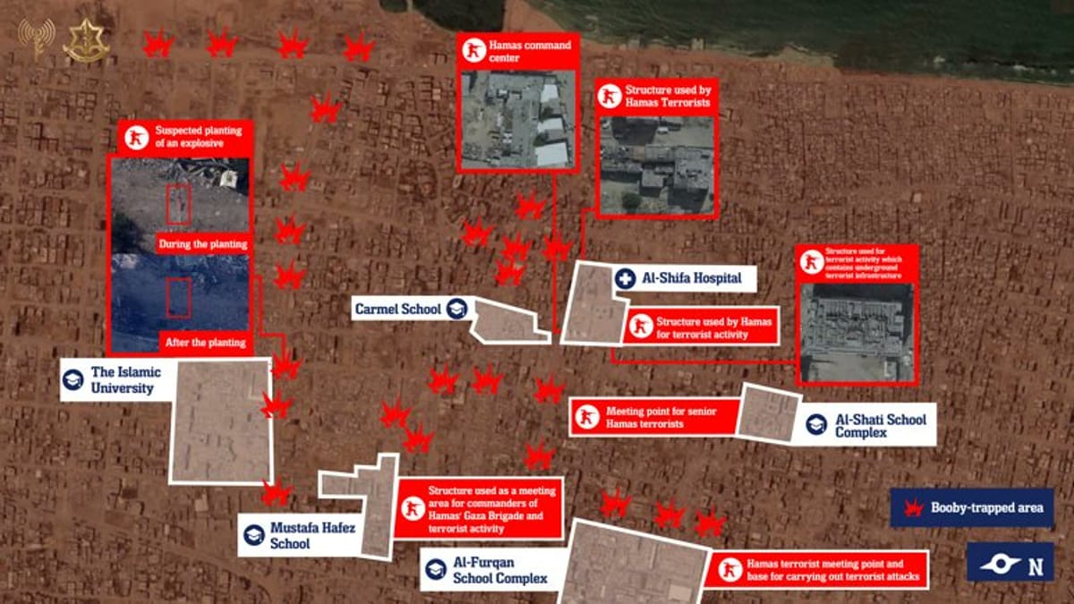
"The IDF reveals today (Wednesday) new intelligence indications pointing to the continued terrorist activity of Hamas from within and near civilian infrastructure in the Gaza Strip, including hospitals, educational institutions, and additional civilian complexes.
"The revealed information clearly demonstrates the cynical exploitation by the terrorist organization, which uses civilian facilities for terrorist activities and to manage the fighting. Hamas continues to use the civilian population as human shields, thereby endangering the lives of many civilians.
"In light of the ongoing terrorist activity, the IDF has warned the population in the southern Rimal neighborhood area, which includes civilian populations located within terrorist-affected zones.
"The IDF will continue to operate against terrorist organizations in Gaza in order to protect the citizens of the State of Israel and is prepared to expand the scope of action as needed."