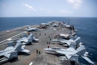
A new analysis of satellite imagery has revealed that American naval forces have quietly executed a major engineering project in the Strait of Hormuz, creating an alternative shipping lane that circumvents Iranian control over the vital waterway. According to high-resolution satellite photographs collected over recent months, the US Navy has dredged and deepened the seabed along a route between the Omani coastline and a nearby island, establishing a new passage outside the traditional international shipping corridor.
The satellite monitoring shows that in recent months, American forces undertook an underwater excavation operation, scraping and deepening the ocean floor to widen a shipping route that previously could not accommodate large oil tankers. This new channel runs close to Oman's coast, beyond the operational reach of the Iranian regime.
The original natural shipping lane measured approximately 1,600 feet wide with a natural depth of around 93 feet, dimensions sufficient for standard commercial vessels but inadequate for the massive oil tankers known in the petroleum industry as VLCCs (Very Large Crude Carriers).
Over recent months, the US Navy re-engineered the route, dredging the seabed and conducting widening operations along the passage located between the Omani island of Jazirat Musandam and the Omani mainland.
The channel has now become one of the strait's major new traffic arteries, with the United States moving millions of barrels of oil through it nightly. Thanks to Jazirat island flanking the route from the north and the curvature of the Earth, Iranian forces cannot effectively target attacks on the new passage.