A notable weather change is anticipated across Israel in the coming days, transitioning from mild conditions to a period of stronger winds and increased precipitation, according to recent forecasts.
Thursday, January 8, is expected to remain relatively warm, with daytime highs reaching around 24°C in coastal areas like Tel Aviv, accompanied by light winds and minimal chance of rain at just 2%.
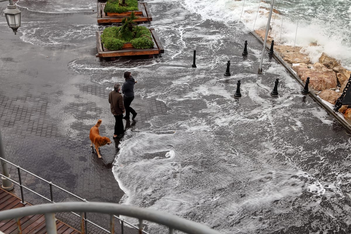
Conditions are projected to worsen significantly by Friday, January 9, as a storm moves in, bringing strong winds up to 75 km/h during the day and gusts potentially higher in exposed areas.
Precipitation chances spike to 75% during daytime hours, with intermittent rain likely affecting northern, central, and southern regions, including the Negev.
Nighttime temperatures will hover around 16°C, with winds easing slightly to about 24 km/h.
Authorities have not issued specific flash flood warnings yet, but heavy rain could pose risks in low-lying areas like the Judean Desert and near the Dead Sea, while higher elevations such as Mount Hermon may see light snow if temperatures drop further.
Marine conditions along the Mediterranean coast are expected to turn rough due to the winds, potentially leading to wave heights that could endanger boating and coastal activities, though exact measurements remain unconfirmed in current reports.
The storm's intensity is forecast to peak on Friday but begin subsiding by evening.
Over the weekend, weather should improve gradually. Saturday, January 10, may still feature partly cloudy skies with a 46% chance of light rain and winds around 36 km/h during the day, dropping temperatures to highs of about 19°C.
By Sunday, January 11, conditions are expected to stabilize further, with clearer skies, reduced precipitation at 2%, and a slight warming trend to highs near 20°C, accompanied by winds of approximately 35 km/h.
Meteorologists advise residents to prepare for potential disruptions.
This system follows a pattern of variable winter weather, with recent reports indicating a temporary break from earlier rains but a return to unsettled conditions mid-week.