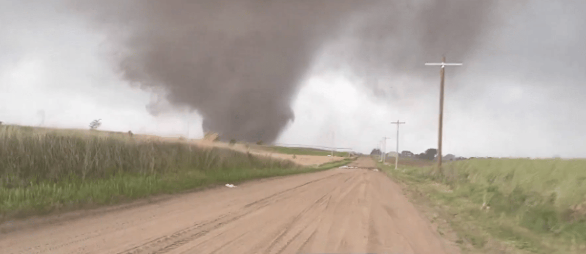
Millions of Americans across the central United States are facing one of the most dangerous storm outbreaks of the season, as a sprawling weather system tore through Nebraska, Kansas, Iowa, and Minnesota, bringing with it massive tornadoes, destructive winds, and hail the size of softballs.
The scale of the system forced the National Weather Service to issue severe warnings across multiple states. In Hebron, Nebraska, authorities took the rare step of declaring a "tornado emergency" - the highest-tier alert, reserved for situations where a catastrophic tornado poses an immediate threat to populated areas.
Hail, Wind, and Darkness
The storms announced themselves with unusual ferocity. In the town of Palmer, Nebraska, hailstones measuring nearly nine centimeters in diameter, roughly the size of a softball, pelted homes and vehicles. Wind gusts exceeding 120 kilometers per hour tore through the South Dakota–Nebraska border region, ripping roofs from agricultural buildings, overturning a residential trailer, and bringing down power lines and trees across wide areas. Thousands of residents were left without electricity.
Fox News and Weather Channel storm-chasing crews deployed in the field reported treacherous driving conditions, with visibility severely reduced by driving rain and hail.
Flash Flood Threat
With the ground already saturated from earlier rainfall, meteorologists are warning of flash flooding in the most exposed areas, with rainfall totals of up to ten centimeters expected in vulnerable locations. Residents in threatened zones have been urged to stay tuned to emergency broadcasts and take shelter in solid structures on lower floors.
The Worst May Be Yet to Come
Forecasters delivered a sobering message on Monday: this is not over. The atmospheric conditions currently in place, a volatile combination of warm, humid air colliding with powerful upper-level winds, are precisely the ingredients that produce long-track tornadoes, capable of staying on the ground for extended distances and carving destruction across wide swaths of territory.
Meteorologists warned that the system is expected to intensify significantly in the coming hours.