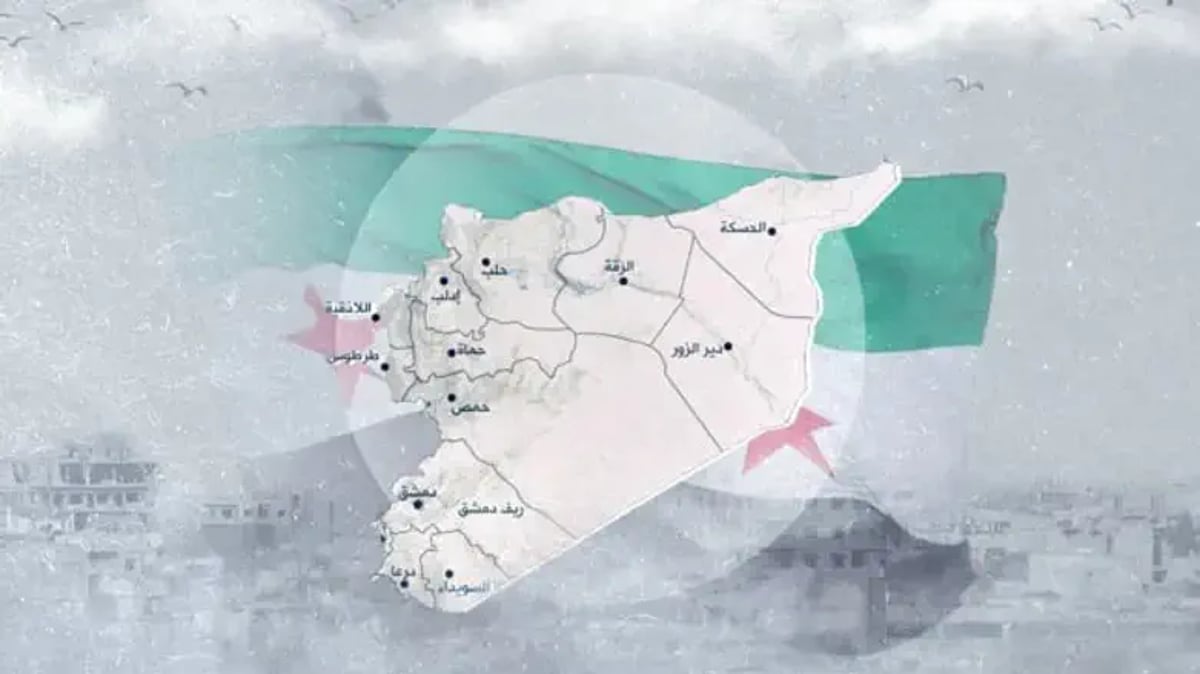
The geopolitical landscape of the Middle East is witnessing a silent but monumental transformation following the collapse of the Assad regime. In a move that has caught the attention of international observers, the new Syrian government has begun circulating official maps that no longer include the Golan Heights within the borders of the Syrian Republic. This change appears in state media and official government publications, marking the first time in over half a century that Damascus has visually abandoned its claim to the territory.
An article featured in the government newspaper al-Thawra, in only its 14th edition since the fall of the previous regime, displayed a map that notably excludes the heights. Instead, the map shows only the Quneitra district, which Israeli forces entered to establish a buffer zone following the chaos of the regime's collapse. Reports indicate that the Syrian Foreign Ministry has also adopted this new imagery in its official channels, effectively redrawing the country's recognized boundaries in a way that aligns with the current territorial reality. Israel originally took control of the Golan Heights during the 1967 war and formally enacted sovereignty over the region in 1981.
This cartographic shift follows reports of intense and dramatic behind-the-scenes negotiations between Jerusalem and the emerging leadership in Damascus. According to recent disclosures, Israel had been positively considering a landmark proposal to hand over Mount Dov and the Shebaa Farms to Syria. In exchange for this strategic concession, the Syrian leadership would have officially withdrawn its long standing claim to the entirety of the Golan Heights. This potential deal represented a historic opportunity to settle one of the most volatile border disputes in the region and move toward a more stable relationship between the two neighbors.
However, these sensitive negotiations reportedly came to a halt following the brutal massacres of Druze civilians in the Suwayda region. The internal instability and violence within Syria temporarily stalled the diplomatic momentum, yet the appearance of these new maps suggests that the desire to move past the old territorial wars remains strong within the new administration. By omitting the Golan Heights, the Syrian government may be signaling a pragmatic approach to foreign policy, prioritizing internal reconstruction and regional stability over a lost cause. As the new leadership finds its footing, the absence of the Golan on official maps serves as a powerful indicator that the era of total war and frozen disputes may finally be giving way to a new, albeit fragile, reality in the Levant.