Following an unusually dry and warm period that extended well into the late autumn months, Israel is now bracing for its first significant winter weather system of the season. For the past week, residents across the country enjoyed mild temperatures and clear skies, which provided a brief reprieve from the typical winter chill. However, meteorological patterns in the Mediterranean are now shifting rapidly as a cold front moves in from the north. This transition marks the official end of the "comfortable" transitional weather, moving the country into a period of high intensity storms that historically bring both vital water to the Sea of Galilee and the danger of urban flooding.
A Stormy Tuesday Ahead
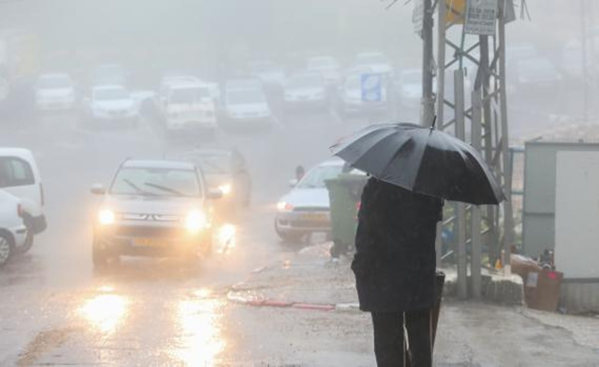
The significant shift in weather patterns will begin in earnest on Tuesday morning. Residents should prepare for partly cloudy skies that will quickly give way to localized rain, primarily concentrated in the northern regions and along the coastal plain. Unlike the light drizzles seen earlier in the season, these rains are expected to be intense and accompanied by isolated thunderstorms, particularly in the north.
As the day progresses, the cooling trend will become more pronounced. By the afternoon, the risk of localized flooding will increase significantly, especially in the northern coastal plain. Municipalities are being advised to clear drainage systems as the volume of water expected in a short period could overwhelm local infrastructure. The drop in temperatures will be noticeable, marking a definitive departure from the mild conditions of the previous week.
Midweek Stabilization and Rising Winds
Wednesday will offer a brief reprieve from the heavy rain, with skies turning partly cloudy to clear. While a slight rise in temperatures is expected, the morning hours may still see light drippings along the coastline. This trend continues into Thursday, where the mercury will remain relatively stable, providing a pleasant but crisp atmosphere for outdoor activities.
However, Thursday morning will bring a different kind of weather challenge. Strong easterly winds are forecasted to sweep through the northern mountains and the Samaria region. These gusty conditions can often lead to increased dust in the air and higher risks for brush fires if the vegetation remains dry from the preceding months.
The Weekend Outlook
The week will conclude with another minor shift on Friday. Temperatures are set to drop slightly once again as clouds move back into the area. Meteorologists predict the possibility of light, localized rain affecting both the northern and central parts of Israel. While not as severe as the Tuesday storm, this moisture will keep the ground damp as the region moves deeper into the winter season.
Travelers and residents are urged to stay updated on the latest weather alerts, particularly those living in low lying coastal areas prone to rapid water accumulation. Driving conditions on Tuesday and Friday are expected to be hazardous due to slippery roads and reduced visibility during peak thunderstorm activity.